Posted by: Zoa | May 17, 2010

Quito, Ecuador

This is my final posting of this 4-month odyssey through Latin America.  This blog puts all my photos and stories in reverse order with the newest ones at the top.  So, if you wish to read the whole adventure in chronological order, just start and the bottom and work your way up, week by week.

I want to thank everyone who has sent emails, posted comments, and encouraged me throughout this journey.  I´ve traveled alone for much of these past four months, so I´ve appreciated having your virtual companionship throughout this journey.

I´ve ended my journey in Quito, the capital of Ecuador.  This city would be a wonderful place to begin a visit to South America, especially if you´d like to take a cruise through the Galapagos.  Flights between here and the US are easy to find, which is why I´m flying back to San Francisco from here at dawn tomorrow.

Another thing that makes Ecuador an easy entry point to South America is that their currency is the US dollar.  Yes, the entire country does its business with American bills — ones, fives, tens, and twenties.  However, except for the Sakagawea dollar coins, Ecuador mints its own nickles, dimes, quarters and halves with its own leaders stamped on them.

Quito, Ecuador (2850 meters)

Quito´s location is wonderfully scenic and dramatic.  The city sits in the middle of the Andes, surrounded by four snow-capped volcanoes, at least one of which is active.  Wikipedia says that Quito is the only capital in the world to be directly menaced by an active volcano.

Although Quito is almost on the equator, the city stays cool and fresh because of its altitude.  I took the photo above while hiking in the hills above the city today.  “Hills” is an understatement.  I was above 4300 meters when I took this photo from the slopes of Volcan Pichincha.

Guagua Pichincha (4794 meters)

Volcan Pichincha is right in Quito´s back yard.  A cable car makes the climb easy by taking you to about 4100 meters.  From there, this mountain nature reserve is a perfect place for picnics or serious rock climbing.  Pristine alpine meadows 30 minutes away from a city of about 1,300,000 people is pretty special.

It was here on the slopes of Pichincha in May of 1822 that Ecuador´s revolutionary army won its final and decisive victory against the Spanish, thereby winning Ecuador´s independence.

Convento de San Francisco

Quito has an old town and a new town.  In the old town, there are cathedrals, plazas, fountains, covered walkways, hotels and museums, all with well-preserved colonial architecture dating from the 16th, 17th and 18th century.  The new town is a commercial district of banks, travel agencies and pubs.  There are parks and green, open spaces throughout the city.

Basilica del Voto National

Completed in the 18th century, this gothic basilica is one of the new buildings in Quito´s old town.

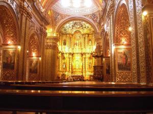
Iglesia de la Compaña de Jesus

Quito´s many churches and cathedrals are a reminder that this is a Catholic country.  The interiors of these buildings are extremely ornate.  This iglesia is said to have required 7000 pounds of gold leaf to cover the interior surfaces.

Typical street in the old city

Many of the streets in the old town are for pedestrians only.  In addition, Quito closes its primary streets to cars and trucks on Sunday, when it becomes a bicyclist´s paradise.

As my final stop in Latin America, Quito has been a delightful surprise.  It´s scenic, historic, clean, friendly, relaxing and inexpensive.  When you plan your trip to South America, don´t miss this lovely place.

Again, thank you all for reading and participating in this blog.  May all your journeys be as adventurous and life-changing — as this one has been for me.

Posted by: Zoa | May 14, 2010

Galapagos!

The most practical way to see the Galapagos is to fly to the islands from either Guayaquil or Quito, and then to live aboard a boat for several days, travelling from island to island.

At a travel agent in Quito, I booked an 8-day cruise to do the “northern itinerary” aboard the Yate Floreana.  The Floreana is a power yacht, with a crew of six plus a naturalist guide.  There are typically 16 passengers in eight cabins.  This is a good number for a Galapagos cruise — small enough to feel as though you have the islands to yourself, yet large enough so that there´s always someone to snorkel or talk with.  By the end of the week, we were all great friends.

We were blessed by good weather and a great naturalist guide named Christian Rueda.  If you´re considering a trip to the Galapagos, I recommend that you contact him directly via email to arrange for a boat tour.

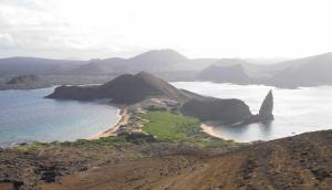
Batholomé and Santiago Islands

The landscape of the Galapagos is dramatic and bizarre.  These volcanic islands feature many different colors and types of lava, cliffs, caves, cones and craters.  After you´ve gotten used to being surrounded by strange rock formations, you notice that they´re teeming with unusual wildlife.

Red and blue footed boobies

Most of the creatures on these islands have few or no predators, so they´re quite unafraid of humans.  Birds are everywhere.  The red and blue footed boobies are separate species living on different islands.  Yet, they have in common a fishing style which involves plunging into the water at high speed from great height — very exciting to see, especially from underwater!

Male Frigate bird

Another colorful winged inhabitant of these islands is the Frigate bird.  The males are easy to spot with their enormous, red, inflated chests.  True to their names, a few of these birds followed our boat day and night.

Swimming with penguins

Although the Galapagos Islands are right on the equator, they´re home to penquins.  Flocks of them would swim past us when we were snorkeling.

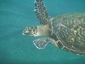
Hawksbill turtle

Much of the remarkable Galapagos wildlife lives below the surface of the ocean.  We went snorkeling about twice a day in clear, blue waters — chilled by the Humbolt Current.  It was quite common to have a Hawksbill or a Green sea turtle swim right up and say hello when we were snorkeling.

Giant land tortoises

One of the most famous inhabitants of these islands is the Giant Land Tortoise.  Although these gentle animals were hunted almost to extinction in the 19th century, an agressive breeding program has increased their numbers back to about 15,000 in the past 20 years.  Shown above are a 90-year old male and his 40-year old mate doing their part to increase their numbers.

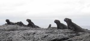
Marine iguanas

Another species found only in the Galapagos are the marine iquanas, which have adapted to a salt-water environment.  They live and swim in the surf around several of the islands.

Land iguana

The marine iquanas have cousins that live only on land — scary creatures that look like modern dinosaurs.

Young sea lion, about six months old

Sea lions were everywhere, always curious about what we were doing, and often mugging or posing for the camera.

A chocolate sea star

Sea life varies from island to island depending on water temperature.  Some islands were more tropical than others.  But everywhere, there were bright and colorful creatures living in the shallow waters around the islands.

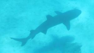
White tipped shark

Naturally, there were sharks, too.  Fortunately for us, they seemed to be well-fed and uninterested in humans.  This one was about 1.5 meters long.  The largest shark we saw was about 2.5 meters.

When I began my journeys through South America back in January, the Galapagos were on a short list of destinations that I was determined to see.  This is truly a special place and I´ve saved the best for last.  I return to the US in about four days.

Posted by: Zoa | May 4, 2010

The Amazon Jungle

No expedition to South America is complete without an excursion into the rain forest.  The Amazon River and its jungles begin in eastern Peru, near the Bolivian border.

An easy way to travel to the Peruvian rain forest is via airplane.  From the muddy frontier town of Puerto Maldonaldo, it takes about 45 minutes via motorboat down the Madre de Dios River to get to The EcoAmazonia Lodge.  I spent three delightful nights here, falling asleep to the sounds of howler monkeys and waking to the screech of parrots.

This lodge is one of many remote resorts that have been created in recent years to preserve the jungle through eco-tourism.  In exchange for use of the land for tourism, the lodge management and staff protect their part of the rain forest from mining, logging and poaching.

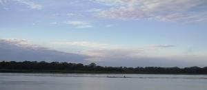
Rio Madre de Dios

Heres a view of the river from the landing at the lodge.  Not shown in this photo are the row of hammocks behind me, and the tables where cold beer is served at sunset.

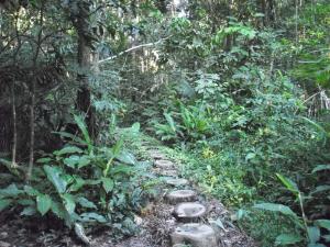
A path into the jungle

From the lodge, there are pathways leading off into the jungle in all directions.  I was impressed by how dark and intense this forest was.  When you go for hikes into this jungle, you´ll be accompanied by a knowledgeable English-speaking guide who shows you which plants can be eaten … and which plants will kill you.

A tranquil lagoon in the jungle

Some jungle trails lead to tranquil lagoons in the middle of the jungle.  These watering holes in the rain forest are fabulous habitats for parrots and many colorful and noisy birds I´ve never seen before.  This lagoon may look like a nice place for a swim, but it´s definitely not.

Two residents of the "tranquil" lagoon

Hidden in the dark waters of the lagoons are many creatures.  If you sit quietly by the lagoon for about an hour, you´ll probably see some of the more secretive residents.  The larger of these two caiman crocodiles is about 1.5 meters long.  He has big, sharp teeth, and he can move very fast.

Making friends with a Marmoset

Not all of the jungle´s residents are dangerous.  Marmosets are the world´s smallest true monkeys.  This one hopped off a branch onto my shoulder.  I think he wanted to come home with me.
Posted by: Zoa | April 30, 2010

Cusco, Peru

After my trek to Machu Picchu, I returned to the charming town of Cusco.  This place wins my vote for the prettiest, friendliest city I´ve visited in all of South America.

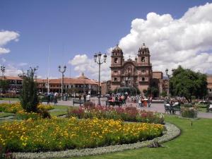
Plaza de Armas, Cusco

Cusco´s Plaza de Armas in the center of town is one of many lovely plazas to sit, read, relax and watch people, pet dogs and feed pigeons.  I could live here.

Backstreet courtyard, Cusco

Every street has surprises.  This courtyard is a gateway to an artist´s studio.

My hotel in Cusco

My hotel room looked out over this plaza from the blue balcony on the 3rd floor on the left.  The students shown in the foreground are preparing the flag of Peru for a big parade that´s about to begin in the Plaza de Armas.

Posted by: Zoa | April 29, 2010

Machu Picchu

You can visit Machu Picchu in a single day:  Traveling from Cusco via bus, train and another bus; following a guide up and down the ruins for three hours; and then returning to Cusco in the evening.  If time is limited, this is an okay way to capture fabulous snapshots like the ones below.

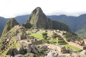
Machu Picchu at dawn

Agricultural terraces at Machu Picchu

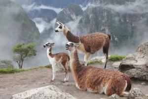
These guys keep the grass short at Machu Picchu

However, a destination as cosmic and spiritual as Machu Picchu deserves a pilgrimage.  So, if you have 4-5 days — and your heart, lungs and legs are in good shape — I recommend that you travel to Machu Picchu by foot, following one of several available trekking routes.  The most famous of these treks is the Inka Trail, which has become so popular that reservations are required months in advance.  I rarely make advance reservations, so I opted for a trail less travelled by — The Salkantay Trek.

Day 1 of the trek

Mount Salkantay (6271 m) towered above my trail for the first two days.  This rugged mountain is rarely climbed, probably due to the avalanches that roar down the sides of this mountain about once an hour.

Day 2 -- Salkantay Pass (4600 m)

The first two days of this trek are a spectacular uphill climb to Salkantay Pass.  At 4600 meters, this point is higher than any mountain in the continental 48 states.  It´s a good place to test your ability to function with little oxygen.

Day 3 -- High altitude rain forest

After crossing the pass, the trail decends into a jungle of flowers, exotic birds, waterfalls and unusual plants.

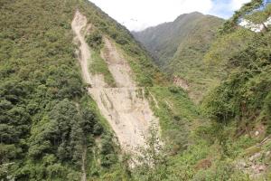
Day 4 -- Final approach and landslides

The fourth and final day of the trek leads through lush, steep canyons.  On these canyon walls a new road was bulldozed about 18 months ago to allow tourists easier access to Machu Picchu.    In January and February of 2010, heavy rains destabilized this roadcut in many places and triggered dozens of landslides like the one shown above.  These landslides closed the railway, destroyed many structures, buried a popular hot spring area, and caused the closure of Machu Picchu for two months.  There is a lesson to be learned here.  My guide told me that this is the first and last road  intended to be cut through these mountains.

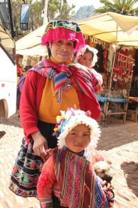
Friendly people everywhere

One of the joys of travelling in Peru are the wonderful people everywhere.

Speaking of great people, if you´d like to experience a trek to Machu Picchu, I recommend that you get in contact with Saulo Danz of T.O.P. Expeditions.  Saulo can arrange all the details for you, including transportation, lodging, pack animals, equipment and food.

If you´re looking for a comfortable, upscale, centrally located place to stay in Cusco, I liked The Royal Inka Hotel.

Posted by: Zoa | April 18, 2010

The World´s Deepest Canyon

Greetings from friendly, colorful, delicious Peru.  I´m now in Arequipa, in southern Peru.

It took two buses and a taxi to get here from Chile.  The taxi was part of the amusing — and slightly confusing — border crossing between Chile and Peru.  The Chilean buses stop in Arica, just south of the border.  From there, you pay about $6 to pile into a collectivo (shared taxi) with several other travellers and their luggage.  Twenty kilometers later, at a large building surrounded by sand dunes, your driver negotiates all the paperwork and baggage inspection as you cross into Peru.  This takes an hour or so.  When your fellow passengers have all been approved for entry, the taxi takes you to the bus station in Tacna, where you catch your next bus northward into Peru.

Arequipa is well-worth the journey.  It´s a charming place full of colonial Spanish architecture, great food and delightful people, surrounded by towering volcanoes and deep canyons.

Monasterio de Santa Catalina, Arequipa

Arequipa is home to a monastery that was closed to the public for more than 400 years.  It´s a city within a city with its own streets and plazas.  Walking through these streets and touring the apartments occupied by as many as 180 women in the 19th century was a journey back in time.
Andean Condor over Colca Canyon

Not far from Arequipa is a canyon that´s 3191 meters deep — from snow-capped volcanos that surround it to a roaring whitewater river at the bottom.  (Technically, it´s the world´s 2nd deepest canyon.  There´s another less-accessible canyon a few kilometers north that´s another 160 meters deeper.)

Even if canyon trekking isn´t in your plans, this is an amazing place for bird watching.  This canyon is home to hundreds of Andean Condors.  They´re the kings of the sky here, with 3 meter wingspans.  Before now, I´d only seen one condor in my life, and that poor creature was in a zoo in California.  Here I was treated to a flock of about twenty of these gorgeous birds, circling overhead on the updrafts that rise out of the canyon.

Local transport

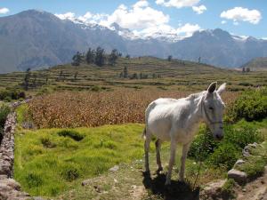
Besides wanting to see the condors, I wanted to have a good hike in the canyon.  Some tourists opt for mules, of which there are many well-cared-for animals available with tour guides.

Canyon trail

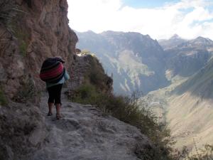
Here´s the trail — 500 meters of vertical cliffs up to the left, and another 500 meters dropping down to the right.  Note the village across the canyon.  Above the village are pre-Inca terraces where vegetables and fruits are grown.  I found dinner and comfortable bed here.   These villages aren´t as primitive as one might think.  Electricity came to these canyon villages two years ago.  My hostel even had a solar heated hot shower — in a bamboo hut.

16th century chapel

Hiking along the canyon walls, I came to villages every few kilometers, where Inca and Spanish architecture clings to the steep hillsides.

Intercity bus in Peru

The roads in these mountains are pretty rough, but the Peruvian buses are reliable.  I enjoy the traditional costumes of my fellow travellers.

From here, my road continues north.  I´ll be on a bus tonight bound for the ancient city of Cusco.  Machu Picchu is my next destination!

Posted by: Zoa | April 10, 2010

The World´s Driest Desert

My work in Concepción is done. The tsunami and earthquake damage maps are complete. The reports have been submitted. It´s time for a vacation!

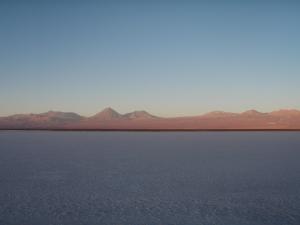
Salar de Atacama (2400 m)

I´m always telling my geology students about the world´s driest desert. I figure it was time for me to see just how dry the Atacama Desert is. It´s so dry here that there are some places in this high altitude valley where rain has NEVER been recorded. To the east are the towering peaks of the Andes, many of which are over 5000 meters. To the west is a coastal range almost as high that prevents any Pacific moisture from reaching this valley. When the snow melts in the mountains, seasonal streams carry precious water down the canyons where it creates a few oases. The rest of the water evaporates and creates great barren salt flats like the one shown above.

San Pedro de Atacama

Here is the oasis of San Pedro. It has been a population center for more than 10,000 years due to its being the only watering hole on a long north-south trail, that was once part of the Inca highway.

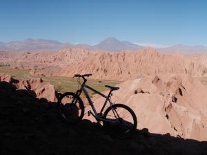
Exploring by bike

There are tours that will take you out into the valley to see the various sites, such as salt lakes, ancient ruins and geysers. Some of the areas near town are best seen by mountain bike.

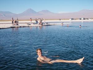
85% salt saturation makes for great bouyancy

On a hot afternoon, a cool dip in a lagoon is relaxing, though not exactly refreshing. The water is extremely salty.

Nightlife in the desert oasis

During the day, this town shimmers in the heat. In the cool evenings, the town shimmers and shakes to a different sound.

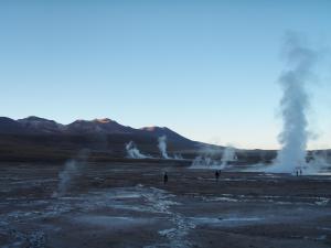
Geysers de Tatio (4320m)

Also near the world´s driest desert is the world´s highest geothermal field. This area hasn´t been developed commercially, probably due to the remoteness of its location. So, it´s a popular tourist destination.

I´ve been in Chile for two months now. It´s an amazing country but it´s time to move on. This will be my last post from Chile. By Monday, I hope to be in Peru.

Posted by: Zoa | March 31, 2010

Santiago de Chile

Welcome to Santiago — Chile´s capital and business center.  

View from Cerro San Cristóbal (870m)

This is a bustling city of about 7 million.  Almost half of Chile´s population of 16 million live here.  Santiago is surrounded by wineries.  A couple hours east are ski resorts, open from June to October.  This time of year, there´s no skiing, but the 4-5000 meter peaks make an impressive backdrop to this city´s skyline.

Santiago´s Metro

Santiago is the most modern of Latin America´s cities.  Its subway system is clean, fast and efficient.  Half the residents of the city live in tall, gleaming apartment buildings with Toyotas and BMWs parked in the garages below.  Everyone has a mobile phone.  There are health food stores, microbreweries and cafés with wifi on every block.  This is a good place to buy more memory cards for your camera, and to get your vaccination for yellow fever (which will be required for entry into Bolivia).

Although the earthquake of February 27th was frightening — especially to Santiaguinos living in 20 story apartment buildings — there was little structural damage here.   This is due to the fact that Santiago has major earthquakes every 25 years, so building codes are strict and well-enforced.  Speaking of earthquakes, my work here in Chile has received some recognition.   Terremoto Prepárate made the front page of the newspaper in Concepción, and page 13, too.

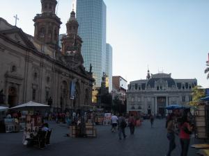
Catedral Metropolitana y Plaza de Armas

Mixed in among all the glass towers and modern conveniences, Santiago has beautiful neoclassical architecture, parks, plazas, museums and other surprises.  The Museo Chileno de Arte Precolumbino is a must see.  So is La Chascona, the secret house Pablo Neruda built for his third wife.

Cerro Santa Lucía

A stunning hilltop garden called Santa Lucía sits right in the middle of the city.

El Mercado Central

As is true throughout Latin America, dining out is a lively adventure.  El Mercado Central is a live fish market with a dozen restaurants in the middle, complete with singing waiters, costumed dancers, parrots, dogs and cats.

Astronomers in the Plaza de Armas

The Plaza de Armas is where you´ll find bars, restaurants, political demonstrations, ethnic music and dancing every evening.  You may also find amature astronomers here with their telescopes ready to show you the craters of the moon or the rings of Saturn … for about 60 cents.  This city has something for everyone.

Posted by: Zoa | March 22, 2010

27 February 2010 — Magnitude 8.8

Chile has great wine, delicious seafood and fresh fruits … and our planet’s biggest earthquakes.  The largest earthquake ever recorded was a magnitude 9.5 earthquake a few hundred kilometers south of Concepción in 1960.  The memory of that earthquake is still fresh in the memories of many Chileans.  The earthquake which occured here three weeks ago was not entirely unexpected.  You can learn more about how this recent earthquake was predicted by clicking here, or you may read all the details in the original science paper.

Plaza Independencia, Concepcion

I arrived in Concepción a week ago.  This is Chile’s 2nd largest city, and the largest city within the epicentral area.  The Plaza Independencia shown above is where Bernardo O’Higgins proclaimed Chile’s independence from Spain two centuries ago.  This plaza is now the center of a major cleanup effort.  I’ve spent the past week volunteering with architects, city planners, seismologist and firefighters to create a pamphlet to advise folks on how to prepare for the aftershocks that are expected for the next 5-7 years.

Concepcion, Chile

Chile is an industrialized country with modern building codes.  So, most of Concepción’s structures survived the earthquake with only cosmetic damage.  However, about 20% of the structures were rendered unsafe, and 5% of the buildings in this city collapsed totally, like the one shown above.

University of Concepcion, Chemistry Department

As always, there were some spectacular examples of earthquake-related damage.  An intense fire destroyed the university’s chemistry department.

Bridge across the Rio Biobio

The bridge above may have had some structural problems which contributed to its collapse.

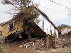
“Tree house” in Dichato

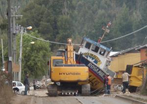
Some of the most dramatic examples of damage were found in a nearby fishing town named Dichato.  Three waves hit this town 10 minutes after the earthquake.  The largest wave was 8 meters high.  The photo above shows how a house was picked up by a wave, carried and deposited on top of a tree.

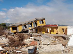
“Split level” home in Dichato

This photo illustrates how high the water was in the middle of town.  Note that the second story was removed from the more solid concrete ground floor.

Road damage in Dichato

The combination of an earthquake followed by a tsunami shattered the roads and then washed them away.

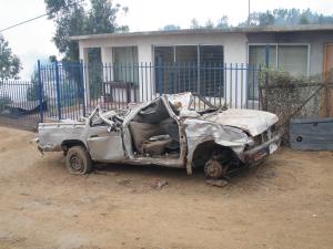
Vehicle damage, Dichato

This is what happens when a vehicle is tumbled by a tsunami.

Returning a boat to the sea, Dichato

This fishing boat is about 15 meters long.  It was found intact in a canyon about one kilometer from the shore.  Because the hull is still in good shape, it’s being towed back to the harbor to be put back into service.

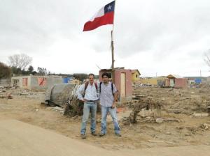
Nick Zoa & Jaime Salazar in Dichato

Throughout these earthquake and tsunami damage surveys, I had the pleasure of working with Jaime Salazar, who lives in Concepcion.

The Chilean coast

The condition of the roads and bridges in this part of Chile were such that travel was sometimes easier by bicycle.

Desembocadura of Biobío River

It’ll take a couple of years to clean up and repair all the damage that central Chile has experienced.  After that, I would recommend Concepción as a travel destination.  It’s a delightful univeristy town — full of students and cafés — with a beautiful river and coastline nearby.

Posted by: Zoa | March 13, 2010

Tierra de Volcanes

Sunset on Lago Llanquihue and Volcan Osorno

From Chiloe, I took buses and ferries north to Puerto Varas, a picturesque vacation spot on the shores of Lago Llanquihue, the 2nd largest lake in Chile. Across the lake rises stunning Volcan Osorno (2652 m).

Iglesia del Sagrado Corazon, Puerto Varas

Puerto Varas is a former German colony full of Bavarian-style homes and 19th century architecture.  German is spoken in this town.  Here you can be served wienerschnitzel, strudel and a pisco sour by a blond, blue-eyed Spanish-speaking waitress, while overlooking an alpine lake flanked by glaciated volcanoes. If you should ever find yourself in Puerto Varas, I recommend the hostel Casa Azul.

Los Saltos del Petrohue and Volcan Osorno

Puerto Varas is the trailhead for wonderful hikes in the nearby national parks, where you´ll find whitewater rivers cascading down from glaciers on the slopes of the volcanoes. The lakes here are gorgeous.

Forest in Petrohue Valley

These latitudes are warmer than those found farther south. Here, there are lush fern forests to explore, full of colorful birds and flowers.

Tolhuaca base camp

From Puerto Varas, I bussed 5 hours north to Temuco to meet an old friend from UC Berkeley grad school. Glenn Melosh is the chief geologist for Global Energy´s geothermal exploration project near the summit of Volcan Tolhuaca (2806 m). Chile has lots of untapped geothermal power, and Tolhuaca may prove to be a significant geothermal energy source.

A Tolhuaca geothermal field

The crater at the top of Tolhuaca has numerous vents and hot springs.  This fumarole is adjacent to the base camp. As there are no roads or easy trails to this location, personnel, food and equipment must be flown up to the base camp via helicopter. Though rugged and rustic, this campsite has a wonderful luxury: Hot showers … provided, of course, by nearby hot springs!

Tolhuaca drill site

The drill site is a short hike up the hill from base camp. Global Energy hopes that this drilling operation will discover a substantial steam-producing geothermal reservoir within the next few months.  The prospects look good so far.

Older Posts »

Categories